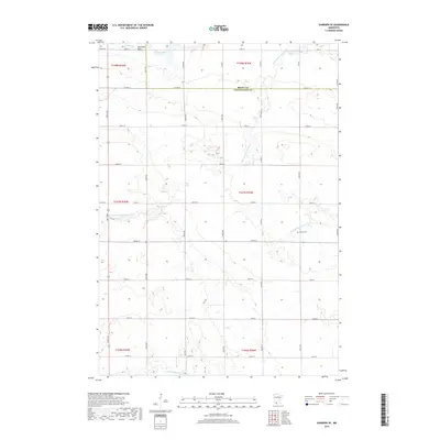
2019 Map of Sanborn SE
USGS Topo · Published 2019About this map
Red Rock Dells and the drainage of Mound Creek characterize the northern reaches of this rural landscape where the border of Brown County and Cottonwood County meets. This area of southern Minnesota is defined by its watershed network, including the Little Cottonwood River which meanders through the central sections, and the Watonwan River along with the N Fork Watonwan River in the south. The survey reveals a strict township and range grid, where section lines are traced by a web of local roads such as 480th Ave and 300th St. For the local historian or genealogist, the Delton Cemetery provides a specific point of reference within the agricultural sections of Delton Township. The map illustrates a mature farming landscape, where nearly every section is accessible by the county road system, reflecting the long-established land use patterns of the region.
Find a feature on this map
41 named features on this map. Tap any name to fly to it.
Don’t see what you’re looking for? This feature index may not catch every label — zoom into the map to look around manually.
Map Details
Editions of this 2019 Sanborn SE Map
This is the sole edition of this map. No revisions or reprints were ever made.
Other maps of this area

1953 · New Ulm
USGS Topo · 1:250,000

1954 · Fairmont
USGS Topo · 1:250,000

1957 · New Ulm
USGS Topo · 1:250,000

1958 · New Ulm
USGS Topo · 1:250,000

1958 · Fairmont
USGS Topo · 1:250,000

1967 · New Ulm
USGS Topo · 1:250,000

1967 · Sanborn
USGS Topo · 1:24,000

1967 · Sanborn SE
USGS Topo · 1:24,000

1967 · Springfield
USGS Topo · 1:24,000

1967 · Sanborn NE
USGS Topo · 1:24,000