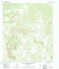
1962 Map of Sanco
USGS Topo · Published 1987About this map
Sanco serves as the focal point for this section of the West Texas landscape, where the rugged terrain is defined by prominent elevations such as Meadow Mountain, Horse Mountain, and Durham Peak. The map documents a territory transitioning through the mid-20th century, marked by a network of energy infrastructure cutting across the drainage basins of Yellow Wolf Creek and Meadow Creek. The expansive I A B Oil Field dominates the southern reaches, characterized by numerous Oil Wells and a Gas Well that indicate the area's economic reliance on petroleum during the 1960s. Natural features like Panther Gap and Rough Creek provide geographic landmarks against the industrial footprint of the scattered wells and the Nolan Co Coke Co boundary line. Later revisions recorded in the 1980s illustrate the continued development of the Pipeline network, overlaying the original topography with modernized energy corridors.
Find a feature on this map
15 named features on this map. Tap any name to fly to it.
Don’t see what you’re looking for? This feature index may not catch every label — zoom into the map to look around manually.
Map Details
Editions of this 1962 Sanco Map
2 editions found

Other maps of this area

1891 · Hayrick
USGS Topo · 1:125,000

1893 · Sweetwater
USGS Topo · 1:125,000

1894 · Hayrick
USGS Topo · 1:125,000

1954 · Big Spring
USGS Topo · 1:250,000

1954 · San Angelo
USGS Topo · 1:250,000

1958 · San Angelo
USGS Topo · 1:250,000

1958 · Big Spring
USGS Topo · 1:250,000

1959 · Dam Draw
USGS Topo · 1:24,000

1959 · Silver
USGS Topo · 1:24,000

1962 · Edith
USGS Topo · 1:24,000