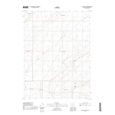
2017 Map of Sand Butte Rim NW
USGS Topo · Published 2017About this map
Sand Butte Rim and Sixmile Rim define the high desert topography of this corner of Sweetwater County. The landscape is marked by the presence of industrial infrastructure, where Brady Field Rd and Brady Plant Rd service the energy operations in the southern portion of the quadrangle. Drainage patterns are characterized by seasonal watercourses like Patrick Draw and Long Draw, which carve through the arid terrain. The map detail reflects the modern intersection of natural landforms and the built environment of Wyoming's oil and gas fields, showing how Patrick Draw Rd traverses the high ridges and draws that dominate the local geography.
Find a feature on this map
13 named features on this map. Tap any name to fly to it.
Don’t see what you’re looking for? This feature index may not catch every label — zoom into the map to look around manually.
Map Details
Editions of this 2017 Sand Butte Rim NW Map
This is the sole edition of this map. No revisions or reprints were ever made.
Other maps of this area

1954 · Rock Springs
USGS Topo · 1:250,000

1958 · Rock Springs
USGS Topo · 1:250,000

1962 · Rock Springs
USGS Topo · 1:250,000

1968 · Cooper Ridge NE
USGS Topo · 1:24,000

1968 · Sand Butte Rim NW
USGS Topo · 1:24,000

1968 · Bitter Creek
USGS Topo · 1:24,000

1968 · Black Buttes
USGS Topo · 1:24,000

1968 · Pine Butte
USGS Topo · 1:24,000

1968 · Sand Butte Rim SE
USGS Topo · 1:24,000
1968 · Burley Draw
USGS Topo · 1:24,000