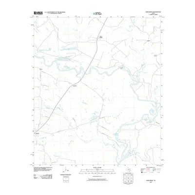
2010 Map of Sand Ridge
USGS Topo · Published 2010About this map
Midway and Antioch anchor this rural landscape along the meandering Trinity River in Madison County. The terrain is defined by a complex network of oxbow lakes and creek systems, including Rattlesnake Lake, Snag Lake, and Patterson Lake, which speak to the river's historical shifts across the bottomlands. To the north, the small settlements of Sand Ridge and Vistula are connected by a web of county roads and oil field access routes, reflecting the region's agricultural and energy-driven economy.
Find a feature on this map
42 named features on this map. Tap any name to fly to it.
Don’t see what you’re looking for? This feature index may not catch every label — zoom into the map to look around manually.
Map Details
Editions of this 2010 Sand Ridge Map
This is the sole edition of this map. No revisions or reprints were ever made.
Other maps of this area

1953 · Palestine
USGS Topo · 1:250,000

1954 · Beaumont
USGS Topo · 1:250,000

1957 · Beaumont
USGS Topo · 1:250,000

1957 · Palestine
USGS Topo · 1:250,000

1962 · Connor
USGS Topo · 1:24,000

1962 · Wyser Bottom
USGS Topo · 1:24,000

1962 · Baker Lake
USGS Topo · 1:24,000

1964 · Sand Ridge
USGS Topo · 1:24,000

1964 · Austonio
USGS Topo · 1:24,000

1964 · Pearsons Chapel
USGS Topo · 1:24,000