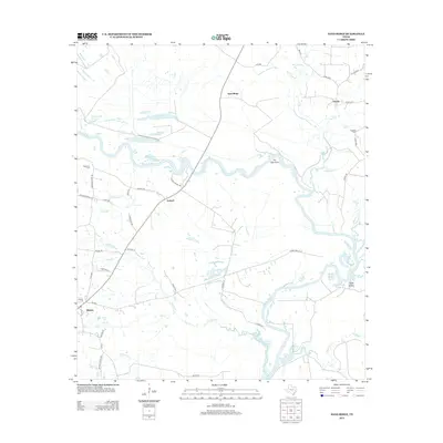
2013 Map of Sand Ridge
USGS Topo · Published 2013About this map
The Trinity River snakes through this Madison County landscape, carving a complex series of oxbows and backwaters including Rattlesnake Lake, Snag Lake, and Brushy Lake. The settlement of Midway anchors the southwestern corner, while the namesake Sand Ridge and the small community of Antioch mark the higher ground above the river bottomlands. This area is defined by its transition from wooded creek drainages like Youngs Cr and Big Cr into the northern reaches of the Livingston Reservoir.
Find a feature on this map
55 named features on this map. Tap any name to fly to it.
Don’t see what you’re looking for? This feature index may not catch every label — zoom into the map to look around manually.
Map Details
Editions of this 2013 Sand Ridge Map
This is the sole edition of this map. No revisions or reprints were ever made.
Other maps of this area

1953 · Palestine
USGS Topo · 1:250,000

1954 · Beaumont
USGS Topo · 1:250,000

1957 · Beaumont
USGS Topo · 1:250,000

1957 · Palestine
USGS Topo · 1:250,000

1962 · Connor
USGS Topo · 1:24,000

1962 · Wyser Bottom
USGS Topo · 1:24,000

1962 · Baker Lake
USGS Topo · 1:24,000

1964 · Sand Ridge
USGS Topo · 1:24,000

1964 · Austonio
USGS Topo · 1:24,000

1964 · Pearsons Chapel
USGS Topo · 1:24,000