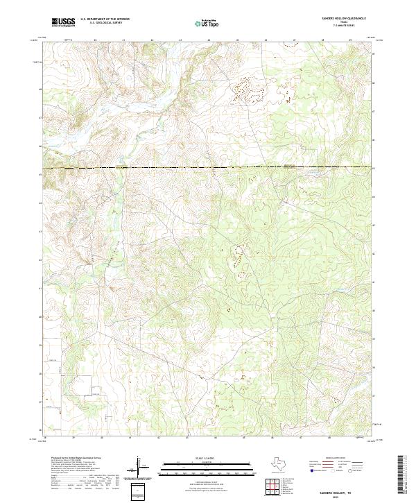
2022 Map of Sanders Hollow
USGS Topo · Published 2022About this map
Sanders Hollow cuts through the high plains of the Texas Panhandle, marking a transition between the elevated plateaus and the drainage basins of the Rolling Plains. This 2022 survey captures the intersection of Motley and Dickens counties, a region defined by its ranching landscape and intermittent water sources. The map tracks the headwaters and seasonal flows of several vital local drainages, including Fishhole Cr, Cottonwood Cr, and Middle Cr, which eventually feed toward the N Wichita River in the southeastern corner. A network of rural county roads, such as Co RD 247 and Co RD 261, provides access to the interior, while Fm 193 serves as the primary paved artery. Evidence of local water management for livestock is seen in features like County Line Tank, emphasizing the importance of every drop in this semi-arid environment.
Find a feature on this map
16 named features on this map. Tap any name to fly to it.
Don’t see what you’re looking for? This feature index may not catch every label — zoom into the map to look around manually.
Map Details
Editions of this 2022 Sanders Hollow Map
This is the sole edition of this map. No revisions or reprints were ever made.
Other maps of this area

1954 · Lubbock
USGS Topo · 1:250,000

1967 · Dickens North
USGS Topo · 1:24,000

1968 · East Afton
USGS Topo · 1:24,000

1968 · Roaring Springs
USGS Topo · 1:24,000

1968 · Russellville
USGS Topo · 1:24,000

1968 · Dumont
USGS Topo · 1:24,000

1968 · China Canyon
USGS Topo · 1:24,000

1968 · East Afton NE
USGS Topo · 1:24,000

1968 · Sanders Hollow
USGS Topo · 1:24,000

1968 · Afton
USGS Topo · 1:24,000