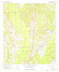
1964 Map of Sandersville
USGS Topo · Published 1976About this map
Southern Railroad tracks cut diagonally through this portion of Jones County, anchoring the growth of Sandersville during the mid-1960s. The town's layout includes a Sandersville Sch and multiple burial sites like Sandersville Cem, while the surrounding landscape is marked by the presence of a Refinery and an extensive Oil Field to the north. These industrial features contrast with the rural heritage evidenced by several country churches, including Mt Moriah Ch Cem and Liberty Ch.
Find a feature on this map
47 named features on this map. Tap any name to fly to it.
Don’t see what you’re looking for? This feature index may not catch every label — zoom into the map to look around manually.
Map Details
Editions of this 1964 Sandersville Map
4 editions found
Other maps of this area

1953 · Hattiesburg
USGS Topo · 1:250,000

1958 · Hattiesburg
USGS Topo · 1:250,000

1963 · Waldrup
USGS Topo · 1:24,000

1963 · Heidelberg
USGS Topo · 1:24,000

1964 · Heidelberg SW
USGS Topo · 1:24,000

1964 · Moss
USGS Topo · 1:24,000

1964 · Sandersville
USGS Topo · 1:24,000

1964 · Laurel East
USGS Topo · 1:24,000

1964 · Laurel West
USGS Topo · 1:24,000

1964 · Myrick
USGS Topo · 1:24,000