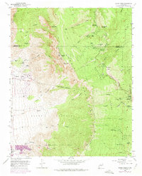
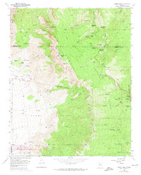
1961 Map of Sandia Crest
USGS Topo · Published 1975About this map
Sandia Mountains dominate this landscape, rising sharply through the Cibola National Forest to the high points of Sandia Crest and Sandia Peak. This map records the mid-century infrastructure of the range, from the Radio Towers and Ski Tow near the summits to the primitive Crest Trail and numerous named canyons such as Cañon de la Cueva and Tejano Canyon. Historically significant land divisions like the Elena Gallegos Grant and Sandia Pueblo Grant reveal the complex legacy of regional land tenure. Pockets of human habitation and recreation are documented at Ellis Ranch, the Juan Tabo Cabin, and the La Madera Ski Area. On the lower eastern slopes, the small settlement at Cañoncito and the Cañoncito Cemetery provide touchstones for local genealogical research, while the La Luz Mine points to the area's mineral prospects.
Find a feature on this map
69 named features on this map. Tap any name to fly to it.
Don’t see what you’re looking for? This feature index may not catch every label — zoom into the map to look around manually.
Map Details
Editions of this 1961 Sandia Crest Map
5 editions found
Other maps of this area

1888 · Bernalillo
USGS Topo · 1:125,000

1889 · Albuquerque
USGS Topo · 1:125,000

1892 · San Pedro
USGS Topo · 1:125,000

1893 · Albuquerque
USGS Topo · 1:125,000

1934 · Alameda
USGS Topo · 1:24,000

1934 · East Albuquerque
USGS Topo · 1:24,000

1938 · Albuquerque
USGS Topo · 1:62,500

1954 · Sandia Crest
USGS Topo · 1:24,000

1954 · Alameda
USGS Topo · 1:24,000

1954 · Placitas
USGS Topo · 1:24,000
Featured Places
- Albuquerque, NM
- Cedar Crest, NM
- Evergreen Hills Subdivision, NM
- Cooper LS Ranch, NM
- Glenwood Hills, Albuquerque