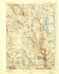
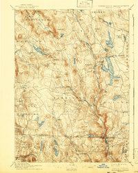
1897 Map of Sandisfield
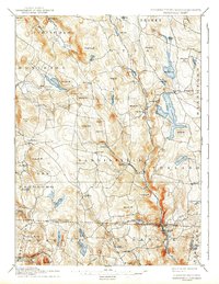
USGS Topo · Published 1937About this map
Otis Reservoir and the headwaters of the Farmington River dominate this late 19th-century survey of the Berkshire highlands. The landscape is defined by a dense network of hill-country settlements like Sandisfield, New Boston, and Montville, which were established along the Clam River and Buck River. This era shows the region before modern reforestation, where family-named peaks such as Kingsbury Mt and Morley Hill stood over a mosaic of small farms and local roads. The map captures the vital water power economy of the day, with numerous ponds like Lake Garfield and Benton Lake supporting early industry. Southward across the Massachusetts Connecticut line, the terrain continues into the Litchfield hills, featuring North Colebrook and the secluded Doolittle Pond. It is a detailed portrait of a rural New England community at its post-Civil War peak of development.
Find a feature on this map
80 named features on this map. Tap any name to fly to it.
Don’t see what you’re looking for? This feature index may not catch every label — zoom into the map to look around manually.
Map Details
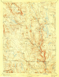
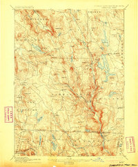
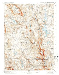
Editions of this 1897 Sandisfield Map
7 editions found

Other maps of this area

1885 · Sheffield
USGS Topo · 1:62,500

1886 · Chesterfield
USGS Topo · 1:62,500

1886 · Becket
USGS Topo · 1:62,500

1887 · Granville
USGS Topo · 1:62,500

1888 · Sheffield
USGS Topo · 1:62,500

1888 · Becket
USGS Topo · 1:62,500

1888 · Sandisfield
USGS Topo · 1:62,500

1888 · Chesterfield
USGS Topo · 1:62,500

1888 · Pittsfield
USGS Topo · 1:62,500

1889 · Granville
USGS Topo · 1:62,500