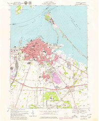
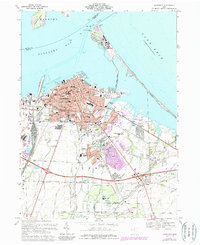
1969 Map of Sandusky
USGS Topo · Published 1979About this map
Sandusky and its extensive waterfront dominate this 1969 survey, where the city’s industrial and recreational identity is etched along the shores of Sandusky Bay and Lake Erie. The map documents a dense urban grid replete with local history, including several faith-based schools like St Marys Sch and the somber Cholera Cem. Transportation networks are heavily represented by the intersecting tracks of the Conrail, Baltimore and Ohio, and Norfolk and Western railroads, which facilitated the movement of goods through the Turning Basin and served the various quarries south of the city.
Find a feature on this map
147 named features on this map. Tap any name to fly to it.
Don’t see what you’re looking for? This feature index may not catch every label — zoom into the map to look around manually.
Map Details
Editions of this 1969 Sandusky Map
5 editions found
Other maps of this area

1901 · Put-In-Bay
USGS Topo · 1:62,500

1901 · Bellevue
USGS Topo · 1:62,500

1903 · Bellevue
USGS Topo · 1:62,500

1903 · Put In Bay
USGS Topo · 1:62,500

1904 · Sandusky
USGS Topo · 1:62,500

1916 · Kelleys Island
USGS Topo · 1:62,500

1919 · Kelleys Island
USGS Topo · 1:62,500

1956 · Toledo
USGS Topo · 1:250,000

1959 · Kimball
USGS Topo · 1:24,000

1959 · Milan
USGS Topo · 1:24,000