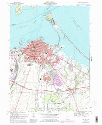
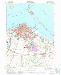
1969 Map of Sandusky
USGS Topo · Published 1989About this map
The city of Sandusky and its Lake Erie shoreline are shown in detail during the late 1960s, a period marked by established urban neighborhoods and the expansion of the Amusement Park at Cedar Point. This survey details the transition from the dense street grid near City Hall to the outlying township lands of Perkins and Huron. The landscape is defined by its maritime and industrial connections, with the Conrail and Baltimore and Ohio railroads serving the waterfront while large quarrying operations are visible to the west. Significant local institutions are documented, including Providence Hospital, the Fairgrounds, and the Griffing-Sandusky Airport. Inland, the map captures a network of small creeks like Pipe Creek and Plum Brook winding through suburban development and golf courses, providing a precise look at the area's mid-century footprint.
Find a feature on this map
61 named features on this map. Tap any name to fly to it.
Don’t see what you’re looking for? This feature index may not catch every label — zoom into the map to look around manually.
Map Details
Editions of this 1969 Sandusky Map
5 editions found
Other maps of this area

1901 · Put-In-Bay
USGS Topo · 1:62,500

1901 · Bellevue
USGS Topo · 1:62,500

1903 · Bellevue
USGS Topo · 1:62,500

1903 · Put In Bay
USGS Topo · 1:62,500

1904 · Sandusky
USGS Topo · 1:62,500

1916 · Kelleys Island
USGS Topo · 1:62,500

1919 · Kelleys Island
USGS Topo · 1:62,500

1956 · Toledo
USGS Topo · 1:250,000

1959 · Kimball
USGS Topo · 1:24,000

1959 · Milan
USGS Topo · 1:24,000