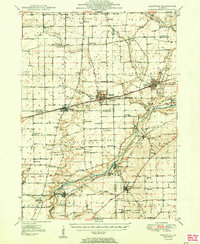
1950 Map of Sandwich
USGS Topo · Published 1950About this map
The Fox River carves a winding path through this Illinois landscape, serving as a primary corridor for the settlements of Sheridan, Millington, and Millhurst. The 1950 terrain is defined by its agrarian and institutional character, prominently featuring the Sandwich Fair Grounds and the Water State Boys Training School. A significant historical marker, the Old Indian Boundary Line, bisects the southern townships, while the Chicago Burlington and Quincy railroad connects the bustling centers of Sandwich, Somonauk, and Plano.
Find a feature on this map
75 named features on this map. Tap any name to fly to it.
Don’t see what you’re looking for? This feature index may not catch every label — zoom into the map to look around manually.
Map Details
Editions of this 1950 Sandwich Map
2 editions found

Other maps of this area

1892 · Morris
USGS Topo · 1:62,500

1892 · Marseilles
USGS Topo · 1:62,500

1892 · Ottawa
USGS Topo · 1:62,500

1915 · Ottawa
USGS Topo · 1:62,500

1916 · Marseilles
USGS Topo · 1:62,500

1918 · Morris
USGS Topo · 1:62,500

1925 · Yorkville
USGS Topo · 1:62,500

1932 · Geneva
USGS Topo · 1:62,500

1934 · De Kalb
USGS Topo · 1:62,500

1937 · De Kalb
USGS Topo · 1:62,500