
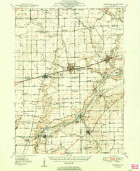
1950 Map of Sandwich
USGS Topo · Published 1950About this map
The Chicago Burlington and Quincy railroad anchors the development of northern Illinois on this 1950 survey, connecting the primary settlements of Sandwich, Plano, and Somonauk. The landscape is a mix of agricultural progress and institutional development, evidenced by the Sandwich Fair Grounds and the sprawling State Boys Training School near the southern boundary. Along the Fox River, smaller communities like Millington and Millhurst sit near industrial and recreational markers such as the Gravel Pit and Silver Springs State Park.
Find a feature on this map
78 named features on this map. Tap any name to fly to it.
Don’t see what you’re looking for? This feature index may not catch every label — zoom into the map to look around manually.
Map Details
Editions of this 1950 Sandwich Map
2 editions found
Other maps of this area

1892 · Morris
USGS Topo · 1:62,500

1892 · Marseilles
USGS Topo · 1:62,500

1892 · Ottawa
USGS Topo · 1:62,500

1915 · Ottawa
USGS Topo · 1:62,500

1916 · Marseilles
USGS Topo · 1:62,500

1918 · Morris
USGS Topo · 1:62,500

1925 · Yorkville
USGS Topo · 1:62,500

1932 · Geneva
USGS Topo · 1:62,500

1934 · De Kalb
USGS Topo · 1:62,500

1937 · De Kalb
USGS Topo · 1:62,500