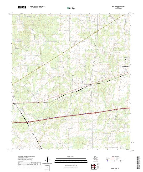
2022 Map of Sandy Fork
USGS Topo · Published 2022About this map
The boundary between Caldwell Co and Gonzales Co cuts diagonally across this Texas landscape, where the rural settlements of Harwood, Sandy Fork, and Thompsonville anchor a network of country roads. The terrain is defined by seasonal waterways and hollows, most notably the prominent Long Hollow and Chalk Hollow, which drain toward the winding course of Sandy Fork. This area maintains a strong connection to its local history through numerous burial grounds, including the Harwood Negro Cem, Fullilove Cem, and Center Union Cem. Small-scale aviation is represented by Flying W Ranch Airport and Gottwald Field, while the southern portion of the map is intersected by the modern transit corridor of the Interstate 10 Westbound Access Road. The settlement pattern reflects a lineage of family landholdings and small communities typical of the central Texas prairie-to-brush transition.
Find a feature on this map
65 named features on this map. Tap any name to fly to it.
Don’t see what you’re looking for? This feature index may not catch every label — zoom into the map to look around manually.
Map Details
Editions of this 2022 Sandy Fork Map
This is the sole edition of this map. No revisions or reprints were ever made.
Other maps of this area

1901 · Flatonia
USGS Topo · 1:125,000

1911 · San Marcos
USGS Topo · 1:125,000

1919 · San Marcos
USGS Topo · 1:125,000

1925 · San Marcos 1-d
USGS Topo · 1:48,000

1925 · San Marcos 4-a
USGS Topo · 1:48,000

1929 · Luling
USGS Topo · 1:62,500

1930 · Lockhart
USGS Topo · 1:62,500

1953 · Seguin
USGS Topo · 1:250,000

1958 · Seguin
USGS Topo · 1:250,000

1959 · Ottine
USGS Topo · 1:24,000