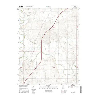
2016 Map of Sandy Hook
USGS Topo · Published 2016About this map
The White River and its East Fork White River define the lower half of this landscape, carving a winding path through the borderlands of Daviess, Knox, and Pike counties. The settlement of Sandy Hook occupies a central position near Jackson Pond, while the smaller community of Cumback lies to the east. The terrain is characterized by its drainage into the river system, with Veale Cr, Aikman Cr, and Mud Creek feeding the larger waterways. Genealogists and local historians can locate several rural burial sites, including Bethel Cem in the north and Logan Cem further south. The map reflects a modern infrastructure of county roads and state routes, such as 57, overlaid on traditional section lines. Further west, the settlement of Rogers sits near the confluence of Mud Cr, highlighting the historical importance of these river junctions for early Indiana development.
Find a feature on this map
69 named features on this map. Tap any name to fly to it.
Don’t see what you’re looking for? This feature index may not catch every label — zoom into the map to look around manually.
Map Details
Editions of this 2016 Sandy Hook Map
This is the sole edition of this map. No revisions or reprints were ever made.
Other maps of this area

1902 · Ditney
USGS Topo · 1:125,000

1903 · Velpen
USGS Topo · 1:62,500

1903 · Petersburg
USGS Topo · 1:62,500

1944 · Montgomery
USGS Topo · 1:24,000

1944 · Glendale
USGS Topo · 1:24,000

1944 · Washington
USGS Topo · 1:24,000

1944 · Monroe City
USGS Topo · 1:24,000

1944 · Wheatland
USGS Topo · 1:24,000

1945 · Sandy Hook
USGS Topo · 1:24,000

1956 · Vincennes
USGS Topo · 1:250,000