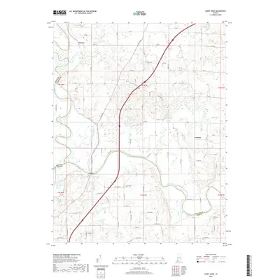
2019 Map of Sandy Hook
USGS Topo · Published 2019About this map
The East Fork White River winds through the tri-county borderlands of Knox, Pike, and Daviess Counties, defining a landscape dominated by river bends and agricultural land. Small settlements like Rogers and Thomas are positioned near the river's path, while the community of Cumback sits further east among the interior grid roads. The region's drainage is managed by a network of waterways including Veale Cr, Aikman Cr, and Mud Cr, which feed into the main river channel. Local history and genealogy are anchored by several rural burial grounds, such as Bethel Cem in the north and Arnold Cem and Logan Cem to the south. Notable wetlands and water features, including Wonder Pond and Jackson Pond, suggest the low-lying nature of the river valley, which has historically influenced the placement of homesteads and the development of local roads.
Find a feature on this map
62 named features on this map. Tap any name to fly to it.
Don’t see what you’re looking for? This feature index may not catch every label — zoom into the map to look around manually.
Map Details
Editions of this 2019 Sandy Hook Map
This is the sole edition of this map. No revisions or reprints were ever made.
Other maps of this area

1902 · Ditney
USGS Topo · 1:125,000

1903 · Velpen
USGS Topo · 1:62,500

1903 · Petersburg
USGS Topo · 1:62,500

1944 · Montgomery
USGS Topo · 1:24,000

1944 · Glendale
USGS Topo · 1:24,000

1944 · Washington
USGS Topo · 1:24,000

1944 · Monroe City
USGS Topo · 1:24,000

1944 · Wheatland
USGS Topo · 1:24,000

1945 · Sandy Hook
USGS Topo · 1:24,000

1956 · Vincennes
USGS Topo · 1:250,000