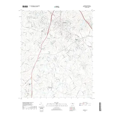
2019 Map of Sanford
USGS Topo · Published 2019About this map
Sanford and its surrounding communities sit at a busy convergence of North Carolina’s central corridors, where the urban landscape of Jonesboro Heights meets the smaller settlements of Tramway and Lemon Springs. The area's geography is defined by a dense network of watercourses, including Big Buffalo Cr and the Upper Little River, which separate the residential clusters from the outlying rural terrain. Local genealogy is anchored by several long-standing landmarks, notably the Cool Springs Baptist Church Cem and the Buffalo-Jonesboro Cem.
Find a feature on this map
38 named features on this map. Tap any name to fly to it.
Don’t see what you’re looking for? This feature index may not catch every label — zoom into the map to look around manually.
Map Details
Editions of this 2019 Sanford Map
This is the sole edition of this map. No revisions or reprints were ever made.
Other maps of this area

1953 · Raleigh
USGS Topo · 1:250,000

1954 · Raleigh
USGS Topo · 1:250,000

1957 · Murchisontown
USGS Topo · 1:24,000
1957 · Olivia
USGS Topo · 1:24,000

1970 · Goldston
USGS Topo · 1:24,000

1970 · Colon
USGS Topo · 1:24,000

1970 · Moncure
USGS Topo · 1:24,000

1974 · White Hill
USGS Topo · 1:24,000
1974 · Vass
USGS Topo · 1:24,000

1974 · Sanford
USGS Topo · 1:24,000