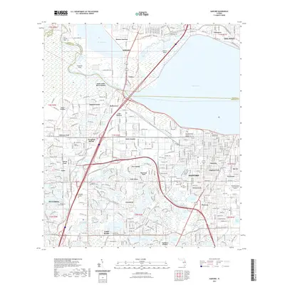
2021 Map of Sanford
USGS Topo · Published 2021About this map
Lake Monroe dominates the northern reaches of this landscape, serving as the wide pivot point for the Saint Johns River as it flows between Volusia and Seminole Counties. The city of Sanford anchors the southern shore, showing a dense grid of residential neighborhoods like Highland Park and Pinecrest that spread toward the Orlando Sanford International Airport. Historically significant settlements such as Enterprise and Benson Junction line the northern banks, while the inland areas to the south and west are defined by a constellation of smaller water bodies including Lake Mary, Sylvan Lake, and Crystal Lake.
Find a feature on this map
88 named features on this map. Tap any name to fly to it.
Don’t see what you’re looking for? This feature index may not catch every label — zoom into the map to look around manually.
Map Details
Editions of this 2021 Sanford Map
This is the sole edition of this map. No revisions or reprints were ever made.
Other maps of this area

1955 · Orlando
USGS Topo · 1:250,000

1956 · Oviedo
USGS Topo · 1:24,000

1957 · Orlando
USGS Topo · 1:250,000

1958 · Orlando
USGS Topo · 1:250,000

1959 · Forest City
USGS Topo · 1:24,000

1962 · Orlando
USGS Topo · 1:250,000

1962 · Pine Lakes
USGS Topo · 1:24,000

1962 · Casselberry
USGS Topo · 1:24,000
1964 · Orange City
USGS Topo · 1:24,000
1965 · Sanford SW
USGS Topo · 1:24,000