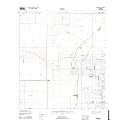
2015 Map of Sanford SW
USGS Topo · Published 2015About this map
Wekiva River corridors and expansive conservation lands define this Central Florida landscape where Lake, Orange, and Seminole Counties meet. The 2015 survey reveals a distinct contrast between the preserved wetlands of The Prairie and the modern residential footprints of Alaqua Lakes and Markham. Significant water features, including Black Water Cr, Seminole Cr, and Rock Springs Run, weave through the terrain, illustrating the hydrological complexity of the region. The map tracks the Florida National Scenic Trail as it traverses the wooded areas near Ethel, offering a detailed view of the interface between wilderness and suburban development. Numerous small water bodies like Lake Markham, Yankee Lake, and Sawyer Lake are scattered throughout the eastern half, many of which serve as central focal points for local communities.
Find a feature on this map
90 named features on this map. Tap any name to fly to it.
Don’t see what you’re looking for? This feature index may not catch every label — zoom into the map to look around manually.
Map Details
Editions of this 2015 Sanford SW Map
This is the sole edition of this map. No revisions or reprints were ever made.
Other maps of this area

1955 · Orlando
USGS Topo · 1:250,000

1957 · Orlando
USGS Topo · 1:250,000

1958 · Orlando
USGS Topo · 1:250,000

1959 · Forest City
USGS Topo · 1:24,000

1960 · Sorrento
USGS Topo · 1:24,000

1960 · Apopka
USGS Topo · 1:24,000

1962 · Orlando
USGS Topo · 1:250,000

1962 · Pine Lakes
USGS Topo · 1:24,000

1962 · Casselberry
USGS Topo · 1:24,000
1964 · Orange City
USGS Topo · 1:24,000