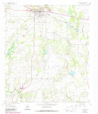
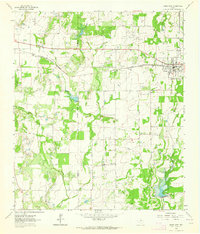
1962 Map of Santa Anna
USGS Topo · Published 1988About this map
The Santa Anna Mountains dominate the northern landscape of this Central Texas survey, providing a backdrop for the settlement of Santa Anna. In the 1960s, the local economy was visibly shaped by the Atchison Topeka and Santa Fe railroad and a sprawling network of energy extraction. This is evidenced by the numerous named petroleum zones, including the Santa Anna West Oil Field and the Santa Anna North (Marble Falls) Oil Field. Beyond the main town, the rural community of Cleveland is marked by the Cleveland Ch and several cemeteries, while the surrounding hills are punctuated by various Quarry and Gravel Pit operations. The drainage patterns of Mukewater Creek and Sweetie Creek illustrate the watershed of the Rolling Plains as it stood before modern development.
Find a feature on this map
20 named features on this map. Tap any name to fly to it.
Don’t see what you’re looking for? This feature index may not catch every label — zoom into the map to look around manually.
Map Details
Editions of this 1962 Santa Anna Map
2 editions found
Other maps of this area

1887 · Coleman
USGS Topo · 1:125,000

1889 · Coleman
USGS Topo · 1:125,000

1924 · Brownwood Reservoir Site
USGS Topo · 1:48,000

1927 · Grosvenor
USGS Topo · 1:62,500

1954 · Brownwood
USGS Topo · 1:250,000
1962 · Speck Mountain
USGS Topo · 1:24,000
1962 · Trickham
USGS Topo · 1:24,000
1962 · Gouldbusk
USGS Topo · 1:24,000

1962 · Santa Anna
USGS Topo · 1:24,000
1962 · Bangs West
USGS Topo · 1:24,000