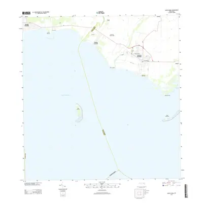
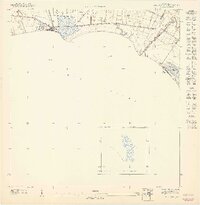
2013 Map of Santa Isabel
USGS Topo · Published 2013About this map
Santa Isabel serves as the central hub of this coastal southern Puerto Rico landscape, situated where the Río Coamo nears the Caribbean Sea. The town is anchored by the Santiago Apostol church and a grid of streets including Calle Muñoz Rivera, extending south toward the Santa Isabel Nautic Club at Punta Cayito. This coastal region reflects a legacy of sugar production at Central Cortada, with several worker settlements like Playita Cortada and Potala Pastillo lining the PR-1 corridor. Offshore, the geography is defined by isolated features such as Cayo Berbería and the eastern Cayos Cabezazos, which guard the entrance to Bahía de Rincón. The map illustrates a transitional landscape where established agricultural communities meet the development of the shoreline near Punta Petrona.
Find a feature on this map
30 named features on this map. Tap any name to fly to it.
Don’t see what you’re looking for? This feature index may not catch every label — zoom into the map to look around manually.
Map Details
Editions of this 2013 Santa Isabel Map
This is the sole edition of this map. No revisions or reprints were ever made.
Other maps of this area

1944 · Santa Isabel
USGS Topo · 1:30,000

1945 · Playa De Ponce
USGS Topo · 1:30,000

1945 · Ponce
USGS Topo · 1:30,000

1945 · Rio Descalabrado
USGS Topo · 1:30,000

1945 · Salinas
USGS Topo · 1:30,000

1946 · Coamo
USGS Topo · 1:30,000
1947 · Rio Descalabrado SE
USGS Topo · 1:10,000
1947 · Playa De Ponce NE
USGS Topo · 1:10,000
1947 · Ponce SE
USGS Topo · 1:10,000
1947 · Santa Isabel NO
USGS Topo · 1:10,000