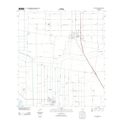
2013 Map of Santa Rosa
USGS Topo · Published 2013About this map
The town of Santa Rosa and the nearby community of Sebastian anchor this 2013 survey of the South Texas landscape. The region is defined by an intricate network of irrigation and water management features essential to the local agriculture, most notably the Willacy Canal and the massive Valley Acres Reservoir. Further north, the North Floodway cuts across the terrain, a critical piece of infrastructure designed to manage seasonal water flow in the Rio Grande Valley.
Find a feature on this map
85 named features on this map. Tap any name to fly to it.
Don’t see what you’re looking for? This feature index may not catch every label — zoom into the map to look around manually.
Map Details
Editions of this 2013 Santa Rosa Map
This is the sole edition of this map. No revisions or reprints were ever made.
Other maps of this area

1929 · Harlingen
USGS Topo · 1:24,000

1929 · Santa Rosa
USGS Topo · 1:24,000

1929 · La Feria
USGS Topo · 1:24,000

1932 · Combes
USGS Topo · 1:31,680

1932 · Harlingen
USGS Topo · 1:31,680

1933 · Santa Rosa
USGS Topo · 1:31,680

1936 · La Feria
USGS Topo · 1:31,680

1953 · Brownsville
USGS Topo · 1:250,000

1956 · San Perlita South
USGS Topo · 1:24,000

1956 · Santa Rosa
USGS Topo · 1:24,000
Featured Places
- Santa Rosa, TX
- Sebastian, TX
- Zapata Ranch Colonia, TX
- Hugh Terry Colonia, TX
- Tierra Bonita Number 2 Colonia, TX