
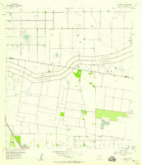
1929 Map of Santa Rosa
USGS Topo · Published 1929About this map
Agricultural development and early irrigation systems define this 1929 survey of the Rio Grande Valley. The town of Santa Rosa serves as a primary hub at the intersection of the Southern Pacific RR and the St Louis Brownsville and Mexico RR, illustrating the critical role of rail transport in the regional economy. The landscape is marked by a transition from large, established cattle estates like Santa Rita Ranch and El Grullo Ranch to a grid of irrigation canals and roads that supported the area's emerging citrus and vegetable industries.
Find a feature on this map
12 named features on this map. Tap any name to fly to it.
Don’t see what you’re looking for? This feature index may not catch every label — zoom into the map to look around manually.
Map Details
Editions of this 1929 Santa Rosa Map
This is the sole edition of this map. No revisions or reprints were ever made.
Other maps of this area

1929 · Harlingen
USGS Topo · 1:24,000

1929 · La Feria
USGS Topo · 1:24,000

1932 · Combes
USGS Topo · 1:31,680

1932 · Harlingen
USGS Topo · 1:31,680

1933 · Santa Rosa
USGS Topo · 1:31,680

1936 · La Feria
USGS Topo · 1:31,680

1953 · Brownsville
USGS Topo · 1:250,000

1956 · San Perlita South
USGS Topo · 1:24,000

1956 · Santa Rosa
USGS Topo · 1:24,000
1956 · Willamar SW
USGS Topo · 1:24,000
Featured Places
- Santa Rosa, TX
- Sebastian, TX
- S and C Colonia, TX
- Yznaga Number 1 Colonia, TX
- Tierra Bonita Number 2 Colonia, TX