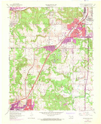
1956 Map of Sapulpa North
USGS Topo · Published 1968About this map
The industrial corridor between Tulsa and Sapulpa defines this mid-century landscape, dominated by the Tulsa-Sapulpa Union railroad and the St Louis - San Francisco line. The map records the expansion of the metropolitan area into communities like Carbondale, Oakhurst, and Prattville while still retaining rural landmarks such as the Indian Mission and the Little Cussetah Ch.
Find a feature on this map
52 named features on this map. Tap any name to fly to it.
Don’t see what you’re looking for? This feature index may not catch every label — zoom into the map to look around manually.
Map Details
Editions of this 1956 Sapulpa North Map
4 editions found

Other maps of this area

1896 · Okmulgee
USGS Topo · 1:125,000

1900 · Okmulgee
USGS Topo · 1:125,000

1901 · Claremore
USGS Topo · 1:125,000

1901 · Nuyaka
USGS Topo · 1:125,000

1912 · Hominy
USGS Topo · 1:125,000

1914 · Kiefer
USGS Topo · 1:62,500

1914 · Claremore
USGS Topo · 1:125,000

1915 · Hominy
USGS Topo · 1:125,000

1916 · Kiefer
USGS Topo · 1:62,500

1916 · Claremore
USGS Topo · 1:125,000