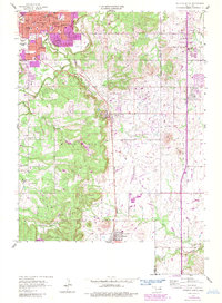
1958 Map of Sapulpa South
USGS Topo · Published 1983About this map
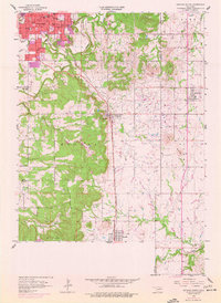
Sapulpa stands at the northern edge of this Oklahoma survey, showing a landscape defined by the extraction economy and early transport lines. Numerous Oil Wells dot the terrain south toward Kiefer and Mounds, illustrating the region's historical role in the petroleum industry. The Burlington Northern railroad serves as the central spine of the area, connecting the growing residential centers with the surrounding rural landscape.
Find a feature on this map
47 named features on this map. Tap any name to fly to it.
Don’t see what you’re looking for? This feature index may not catch every label — zoom into the map to look around manually.
Map Details
Editions of this 1958 Sapulpa South Map
5 editions found
Other maps of this area

1896 · Okmulgee
USGS Topo · 1:125,000

1900 · Okmulgee
USGS Topo · 1:125,000

1901 · Claremore
USGS Topo · 1:125,000

1901 · Nuyaka
USGS Topo · 1:125,000

1912 · Hominy
USGS Topo · 1:125,000

1914 · Kiefer
USGS Topo · 1:62,500

1914 · Claremore
USGS Topo · 1:125,000

1915 · Hominy
USGS Topo · 1:125,000

1916 · Kiefer
USGS Topo · 1:62,500

1916 · Claremore
USGS Topo · 1:125,000