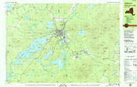
1979 Map of Saranac Lake
USGS Topo · Published 1979About this map
Saranac Lake serves as the central hub in this late-1970s record, surrounded by a dense network of mountain peaks and interconnected waterways. The village is well-established with institutional landmarks including North Country Community College, the Armory, and Pine Ridge Cem. Education and faith are centered at St Bernards Ch and St Bernards Sch, while the nearby Trudeau settlement and the Adirondack Educational Center reflect the area's ongoing development.
Find a feature on this map
108 named features on this map. Tap any name to fly to it.
Don’t see what you’re looking for? This feature index may not catch every label — zoom into the map to look around manually.
Map Details
Editions of this 1979 Saranac Lake Map
2 editions found
Other maps of this area

1895 · Mt. Marcy
USGS Topo · 1:62,500

1896 · Lake Placid
USGS Topo · 1:62,500

1898 · Lake Placid
USGS Topo · 1:62,500

1902 · Mt. Marcy
USGS Topo · 1:62,500

1902 · Saranac
USGS Topo · 1:62,500

1904 · Saranac
USGS Topo · 1:62,500

1904 · Santanoni
USGS Topo · 1:62,500

1904 · Long Lake
USGS Topo · 1:62,500

1905 · Saint Regis
USGS Topo · 1:62,500

1948 · Ogdensburg
USGS Topo · 1:250,000