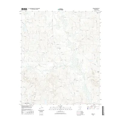
2016 Map of Sardis
USGS Topo · Published 2016About this map
Hughes Springs anchors the southern edge of this East Texas survey, where the terrain is defined by a dense network of creek systems and low-lying wetlands. The hydrology is dominated by Black Cypress Creek, which winds through the central portion of the landscape, joined by numerous tributaries including Kelly Creek, Caney Creek, and Mill Branch. This water-rich environment is evidenced by the frequent marsh symbols and secondary drainage labels like Arbery Branch and Cloninger Creek. Local history and genealogy are preserved through several documented burial sites, such as Rankin Cemetery and Old Union Hill Cemetery, which sit among a complex grid of rural roads. These routes, including FM 130 and Farm Road 161 N, connect isolated homesteads and small family properties across the piney woods of Cass County.
Find a feature on this map
70 named features on this map. Tap any name to fly to it.
Don’t see what you’re looking for? This feature index may not catch every label — zoom into the map to look around manually.
Map Details
Editions of this 2016 Sardis Map
This is the sole edition of this map. No revisions or reprints were ever made.
Other maps of this area

1910 · Linden
USGS Topo · 1:62,500

1914 · Daingerfield
USGS Topo · 1:62,500

1953 · Texarkana
USGS Topo · 1:250,000

1956 · Texarkana
USGS Topo · 1:250,000

1956 · Tyler
USGS Topo · 1:250,000

1961 · Cunningham Creek
USGS Topo · 1:24,000

1962 · Avinger
USGS Topo · 1:24,000

1962 · Lone Star
USGS Topo · 1:24,000

1964 · Daingerfield
USGS Topo · 1:24,000

1965 · Marietta
USGS Topo · 1:24,000