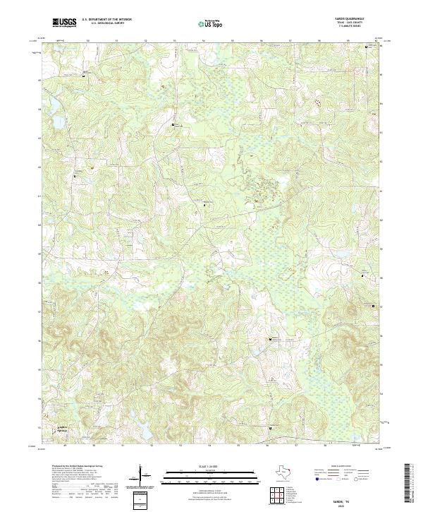
2022 Map of Sardis
USGS Topo · Published 2022About this map
Hughes Springs anchors the southwest corner of this landscape in Cass County, where the terrain is defined by the winding course of Black Cypress Cr and its various tributaries. This portion of East Texas is notable for its high density of rural cemeteries, such as Sardis Cem, Shelton Rankin Cem, and Pine Bluff Cem, which suggest long-standing family settlements and community nodes scattered throughout the wooded drainage basins. The intricate network of county roads, including Co RD 2744 and Co RD 2912, connects these historical sites across a landscape dissected by waterways like Mill Br and Arbery Br. The map reveals a pattern of dispersed homesteads and small-scale land use typical of the region, where narrow creek bottoms like Caney Cr separate upland ridges. This 2022 survey provides a clear view of the contemporary road system while preserving the locations of numerous ancestral burial grounds that define the local genealogy.
Find a feature on this map
75 named features on this map. Tap any name to fly to it.
Don’t see what you’re looking for? This feature index may not catch every label — zoom into the map to look around manually.
Map Details
Editions of this 2022 Sardis Map
This is the sole edition of this map. No revisions or reprints were ever made.
Other maps of this area

1910 · Linden
USGS Topo · 1:62,500

1914 · Daingerfield
USGS Topo · 1:62,500

1953 · Texarkana
USGS Topo · 1:250,000

1956 · Texarkana
USGS Topo · 1:250,000

1956 · Tyler
USGS Topo · 1:250,000

1961 · Cunningham Creek
USGS Topo · 1:24,000

1962 · Avinger
USGS Topo · 1:24,000

1962 · Lone Star
USGS Topo · 1:24,000

1964 · Daingerfield
USGS Topo · 1:24,000

1965 · Marietta
USGS Topo · 1:24,000