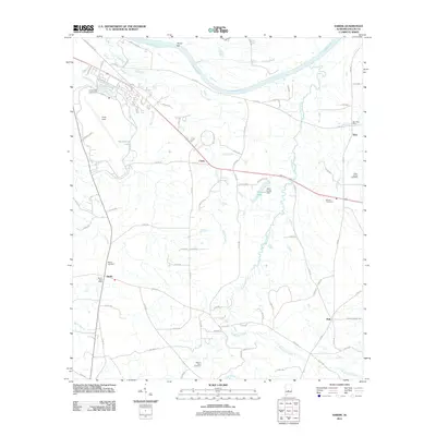
2011 Map of Sardis
USGS Topo · Published 2011About this map
The Alabama River defines the northern boundary of this Dallas County landscape, where the shifting riverbed is marked by features like Tarver Bar. Inland, the terrain is shaped by a network of waterways including Sixmile Creek, Soapstone Creek, and Fourmile Creek, which drain the lowlands toward the river. The presence of Craig Field and its associated infrastructure near the northwestern corner contrasts with the surrounding rural agricultural and timber land.
Find a feature on this map
87 named features on this map. Tap any name to fly to it.
Don’t see what you’re looking for? This feature index may not catch every label — zoom into the map to look around manually.
Map Details
Editions of this 2011 Sardis Map
This is the sole edition of this map. No revisions or reprints were ever made.
Other maps of this area

1953 · Montgomery
USGS Topo · 1:250,000

1956 · Montgomery
USGS Topo · 1:250,000

1957 · Montgomery
USGS Topo · 1:250,000

1957 · Carlowville
USGS Topo · 1:62,500

1957 · Benton
USGS Topo · 1:62,500

1957 · Braggs
USGS Topo · 1:62,500

1958 · Selma
USGS Topo · 1:62,500

1958 · Selma
USGS Topo · 1:24,000

1975 · Benton SE
USGS Topo · 1:24,000

1975 · Selma SE
USGS Topo · 1:24,000