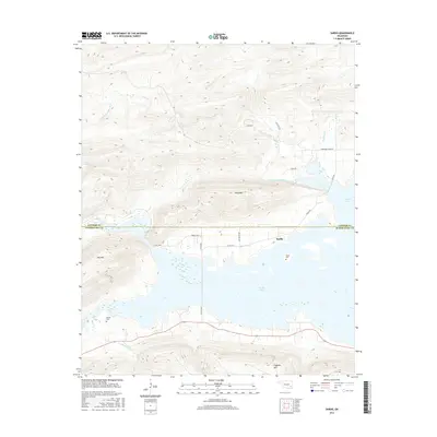
2016 Map of Sardis
USGS Topo · Published 2016About this map
Sardis Lake dominates the central landscape of this Pushmataha County region, its irregular shoreline reaching into the valleys below Wolf Mtn and Mid Mtn. The small settlement of Sardis sits along the northern edge of the water, near the Sardis Cem, while further south across the lake, the Borden Cem rests at the foot of Flagpole Mtn. The terrain is defined by steep ridges and several prominent drainages, including the W Fork Anderson Cr and Anderson Cr to the north, and Maxwell Cr to the southwest. The boundary between Latimer and Pushmataha counties cuts through the rugged northern hills, and a network of local roads such as Savage Hwy and Co RD 4260 provide access through the complex topography that surrounds the reservoir.
Find a feature on this map
24 named features on this map. Tap any name to fly to it.
Don’t see what you’re looking for? This feature index may not catch every label — zoom into the map to look around manually.
Map Details
Editions of this 2016 Sardis Map
This is the sole edition of this map. No revisions or reprints were ever made.
Other maps of this area

1898 · McAlester
USGS Topo · 1:125,000

1901 · Tuskahoma
USGS Topo · 1:125,000

1908 · Tuskahoma
USGS Topo · 1:125,000

1909 · Mc Alester
USGS Topo · 1:125,000

1909 · Tuskahoma
USGS Topo · 1:125,000

1950 · Mcalester
USGS Topo · 1:250,000

1962 · McAlester
USGS Topo · 1:250,000

1965 · McAlester
USGS Topo · 1:250,000

1967 · Hartshorne
USGS Topo · 1:24,000

1971 · Yanush
USGS Topo · 1:24,000