1975 Map of Sardis NW
USGS Topo · Published 1976About this map
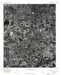
Sardis serves as the primary focal point of this 1975 orthophotograph, situated in Panola County, Mississippi. This specialized aerial-photo map captures the landscape in high contrast, revealing the intricate patterns of agricultural land use and forestry that defined the region during the mid-1970s. The town's grid of streets and buildings is clearly visible against the surrounding patchwork of fields and wooded creek bottoms. By utilizing an orthophotograph rather than a traditional line map, this sheet provides an exceptionally clear view of property boundaries, fence lines, and the natural drainage patterns of the area at the time the imagery was captured on February 21, 1975.
Find a feature on this map
1 named feature on this map. Tap any name to fly to it.
Don’t see what you’re looking for? This feature index may not catch every label — zoom into the map to look around manually.
Map Details
Editions of this 1975 Sardis NW Map
This is the sole edition of this map. No revisions or reprints were ever made.
Other maps of this area

1932 · Sledge
USGS Topo · 1:48,000

1932 · Crenshaw
USGS Topo · 1:62,500

1935 · Crenshaw
USGS Topo · 1:62,500

1935 · Sledge
USGS Topo · 1:62,500

1939 · Sledge
USGS Topo · 1:62,500

1944 · Senatobia
USGS Topo · 1:62,500

1948 · Helena
USGS Topo · 1:250,000

1950 · Helena
USGS Topo · 1:250,000

1952 · Sardis
USGS Topo · 1:62,500

1953 · Sardis
USGS Topo · 1:62,500