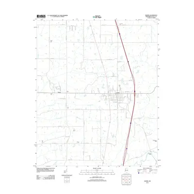
2012 Map of Sardis
USGS Topo · Published 2012About this map
The town of Sardis and its agricultural surroundings in Panola County are meticulously documented in this 2012 survey. The landscape is defined by the drainage of Crooked Cr and the multiple forks of Bear Creek, including N Fork Bear Cr and S Fork Bear Cr, which carve through the terrain toward the Little Tallahatchie River in the southeast. Genealogists will find a wealth of local burial sites, from Rose Hill Cem near the town center to family or community plots such as McIvor Cem, Hebron Cem, and Walton Cem. The settlement of McIvor sits west of the main town, while the transition from flat farmland to the river valley is marked by Jonathans Bluff. The modern transportation corridor, dominated by the interstate, contrasts with the network of older routes like Old Panola Rd and Bakersville Rd that connect these rural communities.
Find a feature on this map
83 named features on this map. Tap any name to fly to it.
Don’t see what you’re looking for? This feature index may not catch every label — zoom into the map to look around manually.
Map Details
Editions of this 2012 Sardis Map
This is the sole edition of this map. No revisions or reprints were ever made.
Other maps of this area

1932 · Sledge
USGS Topo · 1:48,000

1932 · Crenshaw
USGS Topo · 1:62,500

1935 · Crenshaw
USGS Topo · 1:62,500

1935 · Sledge
USGS Topo · 1:62,500

1939 · Sledge
USGS Topo · 1:62,500

1944 · Senatobia
USGS Topo · 1:62,500

1948 · Helena
USGS Topo · 1:250,000

1950 · Helena
USGS Topo · 1:250,000

1952 · Sardis
USGS Topo · 1:62,500

1953 · Sardis
USGS Topo · 1:62,500