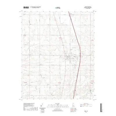
2021 Map of Sardis
USGS Topo · Published 2021About this map
The town of Sardis serves as a focal point for this Panola County landscape, anchored by the Panola County Courthouse and a dense network of residential streets like Claremont ST and Magnolia ST. The surrounding terrain is defined by the drainage basins of the Little Tallahatchie River and its tributaries, including N Fork Bear Cr and S Fork Bear Cr. This modern survey reveals a countryside deeply etched with local history, evidenced by numerous family and community burial grounds such as McIver Cem and Bishop Cem. To the southeast, the topography drops toward the river at Jonathans Bluff, while the Belmont Bridge provides a critical crossing point. The map preserves the exact locations of rural landmarks like Davis Chapel and the Davis Cem, reflecting a settlement pattern where small churches and cemeteries remain vital geographic markers amidst the evolving road network of north Mississippi.
Find a feature on this map
75 named features on this map. Tap any name to fly to it.
Don’t see what you’re looking for? This feature index may not catch every label — zoom into the map to look around manually.
Map Details
Editions of this 2021 Sardis Map
This is the sole edition of this map. No revisions or reprints were ever made.
Other maps of this area

1932 · Sledge
USGS Topo · 1:48,000

1932 · Crenshaw
USGS Topo · 1:62,500

1935 · Crenshaw
USGS Topo · 1:62,500

1935 · Sledge
USGS Topo · 1:62,500

1939 · Sledge
USGS Topo · 1:62,500

1944 · Senatobia
USGS Topo · 1:62,500

1948 · Helena
USGS Topo · 1:250,000

1950 · Helena
USGS Topo · 1:250,000

1952 · Sardis
USGS Topo · 1:62,500

1953 · Sardis
USGS Topo · 1:62,500