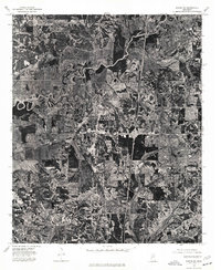
1975 Map of Sardis SW
USGS Topo · Published 1976About this map
Batesville serves as the central hub of this orthophotomap, showing the town's mid-1970s footprint and its expansion toward the north and east. The landscape is defined by the winding course of the Little Tallahatchie River, which meanders through the northern portion of the quadrangle. This aerial perspective, based on 1975 photography, provides a clear view of the agricultural patterns and wooded tracts that surround the growing municipality. The contrast between the grid-like residential blocks and the chaotic oxbows of the river highlights the geographic transition from the developed town center to the alluvial floodplains of the Delta's edge.
Find a feature on this map
2 named features on this map. Tap any name to fly to it.
Don’t see what you’re looking for? This feature index may not catch every label — zoom into the map to look around manually.
Map Details
Editions of this 1975 Sardis SW Map
This is the sole edition of this map. No revisions or reprints were ever made.
Other maps of this area

1932 · Sledge
USGS Topo · 1:48,000

1935 · Crowder
USGS Topo · 1:62,500

1935 · Sledge
USGS Topo · 1:62,500

1939 · Sledge
USGS Topo · 1:62,500

1939 · Crowder
USGS Topo · 1:62,500

1948 · Helena
USGS Topo · 1:250,000

1950 · Helena
USGS Topo · 1:250,000

1952 · Sardis
USGS Topo · 1:62,500

1953 · Sardis
USGS Topo · 1:62,500

1954 · Oakland
USGS Topo · 1:62,500