
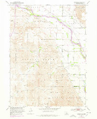
1952 Map of Sargent SE
USGS Topo · Published 1954About this map
Middle Loup River dominates this Custer County landscape, winding through a complex system of irrigation infrastructure including Canal No 1 and Canal No 2. The valley floor is defined by the Chicago Burlington and Quincy railroad, which parallels the river and serves the settlements of Comstock and Wescott. This mid-century survey illustrates the rural civic structure of Douglas Grove and Spring Creek townships, where a dense network of country schools like Glazier Sch and Milla Sch served a distributed farming population. To the south and west of the river, the terrain shifts into dissected uplands drained by Wagner Creek, offering a clear view of the geographic transition between the fertile river bottom and the more varied topography of the surrounding Nebraska plains.
Find a feature on this map
21 named features on this map. Tap any name to fly to it.
Don’t see what you’re looking for? This feature index may not catch every label — zoom into the map to look around manually.
Map Details
Editions of this 1952 Sargent SE Map
2 editions found
Other maps of this area

1951 · Westerville
USGS Topo · 1:24,000

1951 · Ansley NE
USGS Topo · 1:24,000

1951 · Arcadia West
USGS Topo · 1:24,000

1952 · Sargent East
USGS Topo · 1:24,000

1952 · Sargent West
USGS Topo · 1:24,000

1952 · Comstock
USGS Topo · 1:24,000

1952 · Sargent SW
USGS Topo · 1:24,000

1952 · Comstock NW
USGS Topo · 1:24,000

1955 · Broken Bow
USGS Topo · 1:250,000

1956 · Broken Bow
USGS Topo · 1:250,000