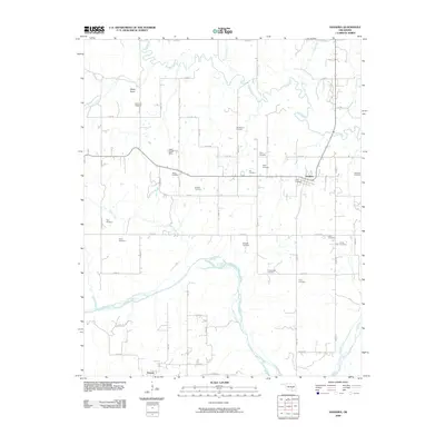
2009 Map of Sasakwa
USGS Topo · Published 2009About this map
The Canadian River meanders across this Oklahoma landscape, defining the southern border of a region marked by numerous ancestral burial grounds and rural settlements. In the northern portion of the map, the town of Sasakwa serves as a local hub near the Little River, while the town of Francis occupies the southwest corner. The high density of family and community-named cemeteries, such as Old Mission Cemetery, Harjo Cemetery, Fixico Cemetery, and Burgess Cemetery, suggests a deeply rooted local genealogy and a historical pattern of family homesteads. The terrain is further shaped by several tributaries, including Cudjo Creek and Clear Creek, while Lake Violet Dam and Rocky Point provide distinct landmarks in the central and western reaches. This 2009 survey by the U.S. Geological Survey documents the intersection of rural Oklahoma road networks and the enduring landscape of Pontotoc and Seminole counties.
Find a feature on this map
54 named features on this map. Tap any name to fly to it.
Don’t see what you’re looking for? This feature index may not catch every label — zoom into the map to look around manually.
Map Details
Editions of this 2009 Sasakwa Map
This is the sole edition of this map. No revisions or reprints were ever made.
Other maps of this area

1896 · Seminole and Prague
USGS Topo · 1:125,000

1896 · Coalgate
USGS Topo · 1:125,000

1899 · Coalgate
USGS Topo · 1:125,000

1900 · Wewoka
USGS Topo · 1:125,000

1900 · Coalgate
USGS Topo · 1:125,000

1901 · Stonewall
USGS Topo · 1:125,000

1954 · Oklahoma City
USGS Topo · 1:250,000

1957 · Ardmore
USGS Topo · 1:250,000

1957 · Oklahoma City
USGS Topo · 1:250,000

1958 · Sasakwa
USGS Topo · 1:24,000