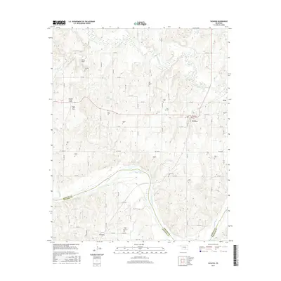
2016 Map of Sasakwa
USGS Topo · Published 2016About this map
The Canadian River cuts a wide path through the southern half of this Oklahoma landscape, marking the boundary between Seminole and Pontotoc counties. Near the river's bend, the town of Francis is defined by a grid of local roads like Francis Rd and Hill-Billy Hill Rd, serving as a hub for the surrounding rural homesteads. To the north, Sasakwa sits at the intersection of several county routes, with its residential streets including Broadway and E Florence St clustered near the Little River drainage system.
Find a feature on this map
51 named features on this map. Tap any name to fly to it.
Don’t see what you’re looking for? This feature index may not catch every label — zoom into the map to look around manually.
Map Details
Editions of this 2016 Sasakwa Map
This is the sole edition of this map. No revisions or reprints were ever made.
Other maps of this area

1896 · Seminole and Prague
USGS Topo · 1:125,000

1896 · Coalgate
USGS Topo · 1:125,000

1899 · Coalgate
USGS Topo · 1:125,000

1900 · Wewoka
USGS Topo · 1:125,000

1900 · Coalgate
USGS Topo · 1:125,000

1901 · Stonewall
USGS Topo · 1:125,000

1954 · Oklahoma City
USGS Topo · 1:250,000

1957 · Ardmore
USGS Topo · 1:250,000

1957 · Oklahoma City
USGS Topo · 1:250,000

1958 · Sasakwa
USGS Topo · 1:24,000