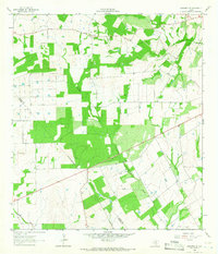
1964 Map of Saspamco SE
USGS Topo · Published 1966About this map
Fairview and the surrounding ranchlands of south-central Texas appear here during a period of steady agricultural and industrial development in the mid-1960s. The landscape is defined by its drainage systems, with Picosa Creek and Borrego Creek carving through the terrain. A notable concentration of activity is visible near the Fairview Cem and the settlement of Stahl, while the presence of Gravel Pits and various Oil Wells indicates the region's reliance on mineral extraction and natural resources. The map captures the dividing line between Wilson Co and Atascosa Co, showing how the local road network and property boundaries respect the underlying topography and watercourses like Prieto Creek and Lucas Creek.
Find a feature on this map
12 named features on this map. Tap any name to fly to it.
Don’t see what you’re looking for? This feature index may not catch every label — zoom into the map to look around manually.
Map Details
Editions of this 1964 Saspamco SE Map
2 editions found
Other maps of this area

1931 · Falls City
USGS Topo · 1:62,500

1936 · Floresville
USGS Topo · 1:62,500

1953 · Crystal City
USGS Topo · 1:250,000

1954 · San Antonio
USGS Topo · 1:250,000

1955 · Crystal City
USGS Topo · 1:250,000

1956 · Pleasanton
USGS Topo · 1:62,500

1957 · San Antonio
USGS Topo · 1:250,000

1958 · Losoya
USGS Topo · 1:24,000

1958 · Saspamco
USGS Topo · 1:24,000

1961 · Crystal City
USGS Topo · 1:250,000