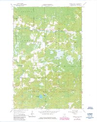
1964 Map of Sassas Creek
USGS Topo · Published 1985About this map
The Little Fork River meanders across this northern Minnesota landscape, intersecting a remote region where the townships of Beatty, Owens, and Angora meet. The map reveals the intricate network of the Lost Lake Swamp and the drainage of Sassas Creek, reflecting the wet, forested terrain characteristic of St. Louis County. A singular local landmark, the East Little Fork Ch, stands as a point of community identity near the riverbanks.
Find a feature on this map
18 named features on this map. Tap any name to fly to it.
Don’t see what you’re looking for? This feature index may not catch every label — zoom into the map to look around manually.
Map Details
Editions of this 1964 Sassas Creek Map
3 editions found
Other maps of this area

1950 · Biwabik NW
USGS Topo · 1:24,000

1951 · Biwabik NW
USGS Topo · 1:24,000

1951 · Britt
USGS Topo · 1:24,000

1952 · Idington
USGS Topo · 1:24,000

1954 · Hibbing
USGS Topo · 1:250,000

1956 · Vermilion Dam
USGS Topo · 1:24,000

1956 · Lost Lake
USGS Topo · 1:24,000

1957 · Hibbing
USGS Topo · 1:250,000

1958 · Hibbing
USGS Topo · 1:250,000

1964 · Hibbing
USGS Topo · 1:250,000