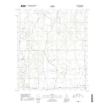
2018 Map of Satsuma
USGS Topo · Published 2018About this map
Satsuma and the northern outskirts of Walker anchor this late 2010s survey of Livingston Parish, revealing a landscape defined by a dense network of residential corridors and winding waterways. The topography is influenced by the many tributaries of the Colyell system, including the Middle Colyell Cr, Hornsby Cr, and Antioch Cr, which weave between family-named roads like Gene Hughes Rd and Tack Covington Rd. Genealogists will find significant value in the distribution of family burial grounds, such as Salem Cem, Lanier Cem, and the S Stafford Cem, which are scattered throughout the rural-suburban interface. The survey also captures local recreational and communal landmarks like Rebel Field, providing a clear picture of the modern footprint of these established Louisiana communities before recent developments further altered the drainage and settlement patterns.
Find a feature on this map
83 named features on this map. Tap any name to fly to it.
Don’t see what you’re looking for? This feature index may not catch every label — zoom into the map to look around manually.
Map Details
Editions of this 2018 Satsuma Map
This is the sole edition of this map. No revisions or reprints were ever made.
Other maps of this area

1934 · Denham Springs
USGS Topo · 1:62,500

1934 · Springfield
USGS Topo · 1:62,500

1939 · Springfield
USGS Topo · 1:62,500

1939 · Denham Springs
USGS Topo · 1:62,500

1942 · Montpelier
USGS Topo · 1:31,680

1942 · Pine Grove
USGS Topo · 1:31,680

1942 · Pride
USGS Topo · 1:31,680

1942 · Watson
USGS Topo · 1:31,680

1942 · Satsuma
USGS Topo · 1:31,680

1950 · Doyle
USGS Topo · 1:31,680