
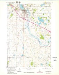
1965 Map of Sauk Centre
USGS Topo · Published 1966About this map
The Sauk Centre township serves as a central hub in Stearns County, defined by the intersection of the Great Northern and Northern Pacific railroads. This mid-1960s survey reveals a landscape transitioning toward modern infrastructure, with a new highway segment clearly marked as Under Construction southeast of the city. The town's historical and social fabric is evidenced by landmarks such as the State School for Girls, the County Fairground, and Sinclair Lewis Park along the shores of Sauk Lake.
Find a feature on this map
35 named features on this map. Tap any name to fly to it.
Don’t see what you’re looking for? This feature index may not catch every label — zoom into the map to look around manually.
Map Details
Editions of this 1965 Sauk Centre Map
2 editions found
Other maps of this area

1953 · Saint Cloud
USGS Topo · 1:250,000

1957 · Saint Cloud
USGS Topo · 1:250,000

1958 · Saint Cloud
USGS Topo · 1:250,000

1965 · Greenwald
USGS Topo · 1:24,000

1965 · Melrose
USGS Topo · 1:24,000

1965 · Padua
USGS Topo · 1:24,000

1965 · Raymond Lake
USGS Topo · 1:24,000

1965 · Elrosa
USGS Topo · 1:24,000

1966 · West Union
USGS Topo · 1:24,000
1966 · Sauk Lake
USGS Topo · 1:24,000