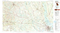
1981 Map of Savannah
USGS Topo · Published 1982About this map
The Savannah riverfront and the expansive coastal lowlands define this 1981 survey, capturing the region as industrial growth and military presence shaped the landscape. The Savannah River serves as the primary artery, winding past Hutchinson Island and Onslow Island while bordering the Savannah National Wildlife Refuge. To the south, the city's infrastructure is dominated by Hunter Army Airfield, while the massive Fort Stewart Military Reservation occupies a significant portion of the western interior.
Find a feature on this map
103 named features on this map. Tap any name to fly to it.
Don’t see what you’re looking for? This feature index may not catch every label — zoom into the map to look around manually.
Map Details
Editions of this 1981 Savannah Map
This is the sole edition of this map. No revisions or reprints were ever made.
Other maps of this area

1918 · Hinesville
USGS Topo · 1:62,500

1918 · Yemassee
USGS Topo · 1:62,500

1918 · Oliver
USGS Topo · 1:62,500

1919 · Pineland
USGS Topo · 1:62,500

1919 · Shirley
USGS Topo · 1:62,500

1919 · Claxton
USGS Topo · 1:62,500

1919 · Egypt
USGS Topo · 1:62,500

1920 · Hardeeville
USGS Topo · 1:62,500

1920 · Okatie
USGS Topo · 1:62,500

1920 · Pembroke
USGS Topo · 1:62,500