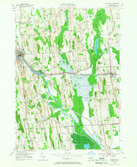
1953 Map of Savannah
USGS Topo · Published 1966About this map
Montezuma Marsh dominates the southeastern quadrant of this mid-century survey, illustrating a landscape defined by its complex water systems. The Erie Canal and the Clyde River snake through the center of the sheet, paralleling the New York Central railroad corridor. This transport-heavy alignment reflects the area's legacy as a vital east-west thoroughfare in upstate New York. In the north and west, the terrain rises into distinct hills like Kelsey Hill and Messner Hill, separated by a grid of rural roads and family-named landmarks such as Noble Corner and Kelsey Corners. The southern portion contains the Montezuma National Wildlife Refuge, where the Old Erie Canal remains visible as a relic of earlier commerce. Genealogists will find numerous rural burial grounds, including the Herrington Cem and Maple Grove Cem, documenting the long-standing settlements of the Galen and Savannah townships.
Find a feature on this map
76 named features on this map. Tap any name to fly to it.
Don’t see what you’re looking for? This feature index may not catch every label — zoom into the map to look around manually.
Map Details
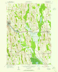
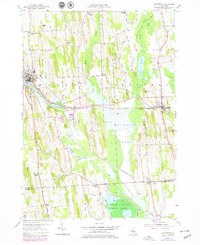
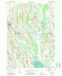
Editions of this 1953 Savannah Map
4 editions found
Other maps of this area

1899 · Auburn
USGS Topo · 1:62,500

1902 · Geneva
USGS Topo · 1:62,500

1902 · Clyde
USGS Topo · 1:62,500

1902 · Weedsport
USGS Topo · 1:62,500

1902 · Auburn
USGS Topo · 1:62,500

1943 · Lyons
USGS Topo · 1:31,680

1943 · Geneva North
USGS Topo · 1:31,680

1943 · Montezuma
USGS Topo · 1:31,680

1943 · Cayuga
USGS Topo · 1:31,680

1943 · Savannah
USGS Topo · 1:31,680