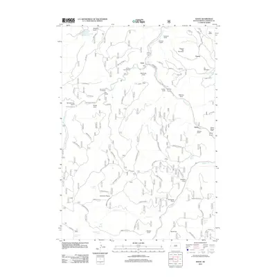
2012 Map of Savoy
USGS Topo · Published 2012About this map
Savoy serves as a central hub in this high-elevation landscape, where the confluence of Spearfish Cr and Little Spearfish Cr creates a dramatic series of cataracts including Roughlock Falls and Spearfish Falls. The topography is defined by deeply cut gulches and high summits such as Ragged Top Mountain and Elk Mountain, which rise above the extensive Limestone Plateau. This 2012 survey illustrates a region heavily shaped by outdoor recreation and forest management, evidenced by the numerous campgrounds like Rod and Gun Campground and an intricate network of timber-access roads, including Timber Gulch Rd and its many branches. Settlements like Elmore and Preston sit along the creek valleys, while more remote features like What the Hell Spring and Dead Ox Cr speak to the area's colorful local nomenclature. To the northwest, Iron Creek Lake provides a notable water landmark amidst the narrow draws of Pettigrew Gulch and Calamity Gulch.
Find a feature on this map
80 named features on this map. Tap any name to fly to it.
Don’t see what you’re looking for? This feature index may not catch every label — zoom into the map to look around manually.
Map Details
Editions of this 2012 Savoy Map
This is the sole edition of this map. No revisions or reprints were ever made.
Other maps of this area

1894 · Deadwood
USGS Topo · 1:125,000

1898 · Sundance
USGS Topo · 1:125,000

1900 · Spearfish
USGS Topo · 1:62,500

1901 · Deadwood
USGS Topo · 1:125,000

1902 · Sundance
USGS Topo · 1:125,000

1915 · Spearfish
USGS Topo · 1:62,500

1916 · Deadwood
USGS Topo · 1:125,000

1953 · Rapid City
USGS Topo · 1:250,000

1954 · Gillette
USGS Topo · 1:250,000

1955 · Gillette
USGS Topo · 1:250,000