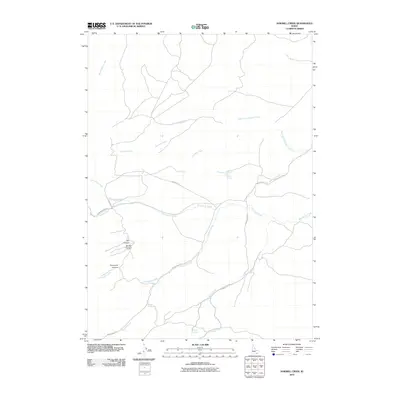
2010 Map of Sawmill Creek
USGS Topo · Published 2010About this map
Sawmill Creek and its many tributaries carve through this portion of Power County, Idaho, creating a landscape defined by dramatic drainage patterns and isolated springs. The hydrologic network is extensive, featuring named waterways such as Starlight Creek, Moonshine Creek, and Squaw Creek. This 2010 survey shows a region largely characterized by its topography and the transport routes that follow these natural contours, including the Moonshine Trl and Starlight Creek Rd. Local landmarks often take their names from the terrain or early inhabitants, seen in features like Keogh Creek, Swede Canyon, and Dry Canyon. Water sources were clearly vital for land use here, as evidenced by the mapping of Sawmill Spring, Corral Spring, and Study Spring, which likely served as critical points for cattle or backcountry travelers in this high-desert environment.
Find a feature on this map
19 named features on this map. Tap any name to fly to it.
Don’t see what you’re looking for? This feature index may not catch every label — zoom into the map to look around manually.
Map Details
Editions of this 2010 Sawmill Creek Map
This is the sole edition of this map. No revisions or reprints were ever made.
Other maps of this area

1934 · American Falls
USGS Topo · 1:62,500

1934 · Michaud
USGS Topo · 1:62,500

1934 · Rockland
USGS Topo · 1:62,500

1936 · American Falls
USGS Topo · 1:62,500

1937 · Rockland
USGS Topo · 1:62,500

1937 · Michaud
USGS Topo · 1:62,500

1938 · Pauline
USGS Topo · 1:48,000

1944 · Arbon
USGS Topo · 1:62,500

1954 · Pocatello
USGS Topo · 1:250,000

1958 · Pocatello
USGS Topo · 1:250,000