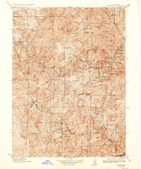
1923 Map of Sawyers Bar
USGS Topo · Published 1936About this map
The Salmon Mountains and the Klamath National Forest define this rugged mining landscape in the early 1900s. The region's economy centers on the Salmon River and its various forks, where deep canyons are dotted with remote mining operations and small settlements. Concentration of activity is particularly dense around Sawyers Bar and Forks of Salmon, where numerous prospects like the Black Bear Mine and White Bear Mine indicate the intense search for gold.
Find a feature on this map
154 named features on this map. Tap any name to fly to it.
Don’t see what you’re looking for? This feature index may not catch every label — zoom into the map to look around manually.
Map Details
Editions of this 1923 Sawyers Bar Map
4 editions found

Other maps of this area

1886 · Shasta
USGS Topo · 1:250,000

1890 · Red Bluff
USGS Topo · 1:250,000

1894 · Red Bluff
USGS Topo · 1:250,000

1894 · Shasta
USGS Topo · 1:250,000

1901 · Redding
USGS Topo · 1:125,000

1909 · Big Bar
USGS Topo · 1:96,000

1913 · Weaverville
USGS Topo · 1:125,000

1914 · Seiad
USGS Topo · 1:125,000

1915 · Big Bar and Vicinity
USGS Topo · 1:250,000

1921 · Shasta Valley Sheet No 7
USGS Topo · 1:24,000