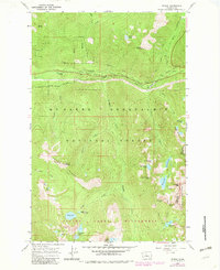
1965 Map of Scenic
USGS Topo · Published 1982About this map
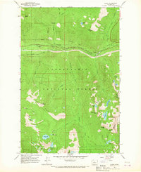
Great Northern Railroad tracks and the Cascade Tunnel dominate the northern landscape of this Cascades survey, tracing the corridor through the mountain pass near the settlement of Scenic. The terrain is defined by the steep descent of the Tye River and its dramatic features like Alpine Falls and Deception Falls. Much of the area is protected as part of the Mt Baker - Snoqualmie National Forest, where high-elevation landmarks such as Mount Sawyer and Alpine Baldy overlook a dense network of backcountry routes, including the Pacific Crest National Scenic Trail and the Deception Creek Trail.
Find a feature on this map
49 named features on this map. Tap any name to fly to it.
Don’t see what you’re looking for? This feature index may not catch every label — zoom into the map to look around manually.
Map Details
Editions of this 1965 Scenic Map
4 editions found
Other maps of this area

1902 · Skykomish
USGS Topo · 1:125,000

1905 · Skykomish
USGS Topo · 1:125,000

1957 · Wenatchee
USGS Topo · 1:250,000

1965 · Captain Point
USGS Topo · 1:24,000

1965 · Evergreen Mtn
USGS Topo · 1:24,000

1965 · Stevens Pass
USGS Topo · 1:24,000

1965 · Mount Daniel
USGS Topo · 1:24,000

1965 · Skykomish
USGS Topo · 1:24,000
1965 · Big Snow Mtn
USGS Topo · 1:24,000
1965 · Scenic
USGS Topo · 1:24,000