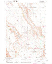
1954 Map of Scenic
USGS Topo · Published 1979About this map
Scenic is a central settlement on this mid-century survey, situated at the junction of high plateaus and the eroding breaks of the Scenic Basin. The town is served by the Chicago Milwaukee St Paul and Pacific railroad, which cuts a diagonal path across the landscape between Hart Table and Scenic Table. The topography is defined by these large, flat-topped tables separated by drainage systems like Spring Draw and Farnum Draw. Educational and community life is documented through the locations of the Kube Sch and North 71 Table Sch, as well as the Scenic Cem. To the southeast, the terrain transitions into the protected lands of the Badlands National Monument, where the sharp relief of the badlands begins to dominate the horizon.
Find a feature on this map
19 named features on this map. Tap any name to fly to it.
Don’t see what you’re looking for? This feature index may not catch every label — zoom into the map to look around manually.
Map Details
Editions of this 1954 Scenic Map
4 editions found
Other maps of this area

1950 · Sheep Mountain Table
USGS Topo · 1:24,000

1950 · Imlay
USGS Topo · 1:24,000

1951 · Heutmacher Table
USGS Topo · 1:24,000

1954 · Scenic
USGS Topo · 1:24,000

1954 · Creston
USGS Topo · 1:24,000

1954 · Scenic SW
USGS Topo · 1:24,000

1954 · Brennan Flat
USGS Topo · 1:24,000

1954 · Quinn Table
USGS Topo · 1:24,000

1955 · Hot Springs
USGS Topo · 1:250,000
1960 · Quinn Table SW
USGS Topo · 1:24,000