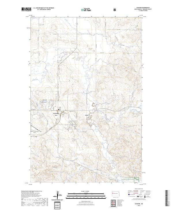
2024 Map of Schafer
USGS Topo · Published 2024About this map
Watford City serves as the primary hub of this McKenzie County landscape, where modern development meets the sprawling northern plains. The residential streets of Watford City, including Frontier Ave and Buffalo Hills Dr, contrast with the rural quiet of nearby Schafer, a settlement marked by the Schafer Cem. This area illustrates the balance between agricultural land and the logistical needs of the region, anchored by the Watford City Municipal Airport to the south. The natural drainage of the territory is defined by several waterways, most notably Cherry Creek and Northfork Creek, which carve through the open terrain. In the southeast corner, the map reaches the protected expanses of the Little Missouri National Grassland, highlighting the transition from developed township to public prairie.
Find a feature on this map
46 named features on this map. Tap any name to fly to it.
Don’t see what you’re looking for? This feature index may not catch every label — zoom into the map to look around manually.
Map Details
Editions of this 2024 Schafer Map
This is the sole edition of this map. No revisions or reprints were ever made.
Other maps of this area

1953 · Watford City
USGS Topo · 1:250,000

1957 · Watford City
USGS Topo · 1:250,000

1958 · Tepee Buttes
USGS Topo · 1:24,000

1959 · Lone Butte NW
USGS Topo · 1:24,000

1959 · Lone Butte NE
USGS Topo · 1:24,000

1967 · Watford City
USGS Topo · 1:250,000

1978 · Schafer
USGS Topo · 1:24,000

1978 · Watford City NE
USGS Topo · 1:24,000
1978 · Schafer SE
USGS Topo · 1:24,000
1978 · Watford City
USGS Topo · 1:24,000