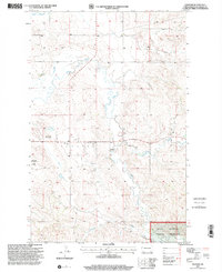
1997 Map of Schafer
USGS Topo · Published 2001About this map
Schafer sits at a geographic crossroads in McKenzie County, documented here just before the turn of the millennium. This landscape is defined by the winding course of Cherry Creek and its tributary, Northfork Cherry Creek, which carve through the high plains. The area shows a distinct contrast between the managed wilderness of the Little Missouri National Grassland in the southeast and the infrastructure supporting nearby development, including a Pipeline network and 4wd trails. Local history is anchored at the Schafer Cem, while the western edge of the map captures the community's modern footprint with the Watford City Municipal Airport and the Watford City Golf Course. Small-scale industrial activity is evidenced by several Gravel Pits located south of the main settlement. The northern reaches are marked by the presence of Tobacco Garden and Sevenmile Creek, illustrating the drainage patterns that have shaped this portion of the North Dakota badlands.
Find a feature on this map
13 named features on this map. Tap any name to fly to it.
Don’t see what you’re looking for? This feature index may not catch every label — zoom into the map to look around manually.
Map Details
Editions of this 1997 Schafer Map
This is the sole edition of this map. No revisions or reprints were ever made.
Other maps of this area

1953 · Watford City
USGS Topo · 1:250,000

1957 · Watford City
USGS Topo · 1:250,000

1958 · Tepee Buttes
USGS Topo · 1:24,000

1959 · Lone Butte NW
USGS Topo · 1:24,000

1959 · Lone Butte NE
USGS Topo · 1:24,000

1967 · Watford City
USGS Topo · 1:250,000

1978 · Schafer
USGS Topo · 1:24,000

1978 · Watford City NE
USGS Topo · 1:24,000
1978 · Schafer SE
USGS Topo · 1:24,000
1978 · Watford City
USGS Topo · 1:24,000